Navigieren auf STI Bus AG
Sprunglinks
Suchbox
Hauptnavigation

Bussalp via Bachsee to Waldspitz


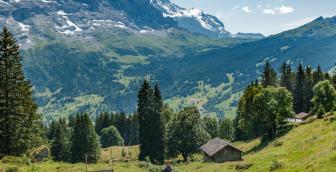
From Bussalp with its marvellous view of the magnificent mountain peaks, the trail first climbs steeply over pastureland to the waypoint Feld, which is the next viewpoint. This mountain hike leads along Reeti to its ridge at almost 2,400 metres above sea level before descending to Bachsee. Through the marvellous Hireleni, the route leads down the valley past the Bachläger waterfall to the end of the hike, the Waldspitz bus stop.
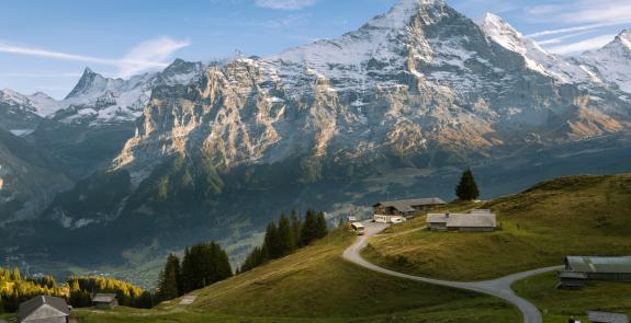
Once you arrive at Bussalp via the 126 busline, it's worth taking a detour to the viewpoint, which is only 15 minutes away. The view of the Bernese Alps with their imposing peaks is breath-taking. The short route can also serve as a warm-up exercise for the 8-kilometre mountain hike ahead. At the very beginning of the hike towards the field, 365 metres of altitude have to be covered, some of which are strenuous. The route turns into a narrow, steep path on the way. A metal footbridge then takes you along a rock face to the Feld waypoint at 2,165 metres above sea level. You should treat yourself to a little breather there, and not just for the view. Because the most strenuous part is still to come. Along Reeti, snow and mud can make the hike difficult until well into July. Good footwear and hiking poles make it easier to cross such passages. The route leads to almost 2,400 metres above sea level. At the ridge, there are seats at the small shelter where you can rest your legs, which might have become a little heavy by now.
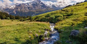
What started out as an uphill section is followed by a
downhill section from this waypoint. The hike down to Bachsee is short and
varied. The wonderful mountain scenery reflected in the mountain lake invites
you to linger. After a short rest and some magical photo moments, we continue
on foot towards our destination. Several small and large watercourses cross the
hiking trail through Hireleni and gather to form an ever-larger watercourse
that plunges into the depths at the Bachläger waterfall. From this waypoint,
the hike leads along a well-surfaced road to the Waldspitz bus stop next to the
inn of the same name.
Overview plan summer

Bussalp mountain restaurant
The cosy mountain restaurant on Bussalp invites you to linger and relax. Treat yourself with culinary delights from the kitchen and enjoy the unique view of Eiger, Mönch and Jungfrau.
Waldspitz restaurant
Waldspitz restaurant welcomes you with a wonderful panoramic terrace and plenty of food and drink.
Prices
Line 126, Grindelwald – Bussalp (mountain line) /summer
Line 126, Grindelwald – Bussalp (mountain line) /summer
Timetable
You can find the timetable for line 126 in the timetables.
Search for a connection
Directly plan your journey at the start of the offer.
Arrival journey
 to Bussalp from Weidli
Further information
Find more information about the journey here (hiking map, altitude profile and/or a video).

Erklärungstext zu Höhenprofil
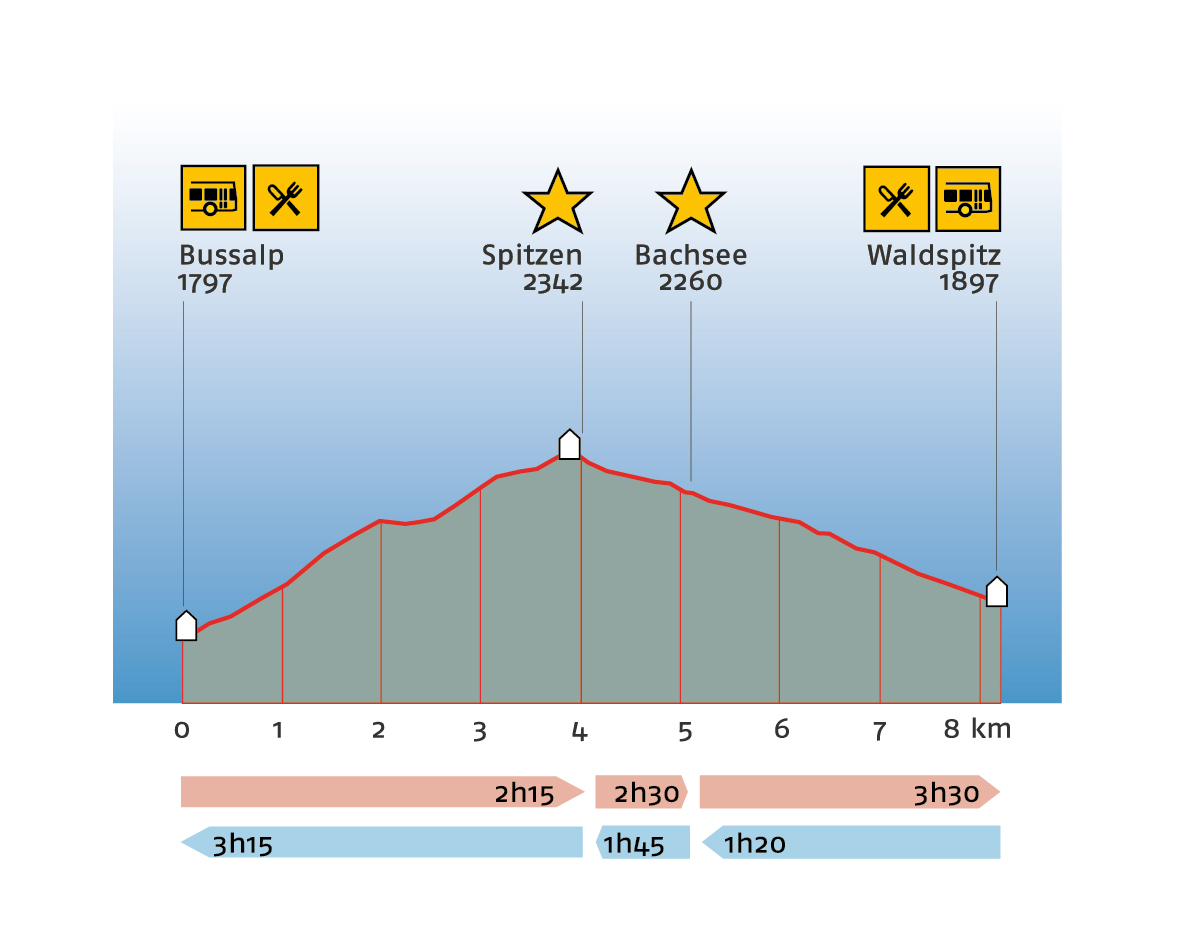
The hike starts on Bussalp at 1,797 metres above sea level. There is a refreshment stop here. The trail leads up to the first highlight of the hike to Spitzen at 2,342 metres above sea level. This is the highest point of the hike. 4 kilometres of the in total 8.2-kilometre route have already been walked at this point. You can expect a walking time of two hours and 15 minutes. The trail continues down to the second highlight of the hike, lake "Bachsee" at 2,260 metres above sea level. The 5-kilometre route takes about two hours and 30 minutes to complete. The route continues down to the destination of the hike: Waldspitz at 1,897 metres above sea level. There is a refreshment stop here. The entire hike is expected to take about 3 hours and 30 minutes to complete. The hike cannot be interrupted en route, as there are no stops along the entire route. Hiking in the opposite direction takes one hour and 20 minutes to Bachsee at 2,260 metres above sea level and one hour and 45 minutes to the highest point of the hike to Spitzen at 2,342 metres above sea level. Plan a total of 3 hours and 15 minutes for the entire hike to Bussalp at 1,797 metres above sea level.
Plan and organise your journey
Have the entire hike compiled as a PDF or download the GPS file.
Our tip: Open the GPS file conveniently on the go with the hiking planner app from the Bernese hiking trails.
Share the journey with your friends.