Navigieren auf STI Bus AG
Sprunglinks
Suchbox
Hauptnavigation

Lochsteinen via Rasthysi to Gaggi Säge


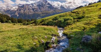
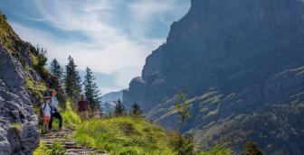
The Lochsteinen bus stop is the starting point for this wonderful hike through a rustic landscape. The route leads through forests and across meadows on a well-surfaced road to the Rasthysi with its inviting self-service restaurant and on to Holewang. The narrow path across the meadows of the Sumpfen area requires a little extra attention; the diverse fauna and flora as well as the huge boulders make hikers pause again and again to marvel at nature. From Allschliechtli, field and forest paths as well as the connecting road finally lead in wide bends down to the Gaggi Säge bus stop near the village of Grindelwald.
20 minutes: At the bus stop, a sign shows how long it takes to walk along the connecting road towards Waldspitz to the first waypoint on this hike, the Rasthysi restaurant. The paved road first leads through the shady forest and then along meadows. If you like, you can take a short break at the self-service restaurant. The next waypoint, Holewang, is only a few minutes' walk away. There, the signpost points to a narrow meadow path through the Sumpfen area. Huge boulders and varied flora and fauna characterise this part of the hike. The path finally leads into a dirt track. If you like admiring natural works of art, you should turn left and follow the dirt track. A few minutes' walk away, nature has created impressive works of art with gnarled deciduous trees.
The trip to the tree experience takes about 20 minutes there and back. The path then leads down across the meadows towards Grindelwald. Before the Bachweidli area, this finally leads into a dirt track. On the following section down to Allschliechtli, a small babbling stream accompanies the hikers. From this waypoint, the trail descends via an access road and forest paths to Brünneli. It only takes just under 10 minutes to get to the Gaggi Säge bus stop, which can easily be walked on the paved road. If you're not tired yet, you can continue the hike. The walk down to the village of Grindelwald only takes another 15 minutes.
Overview plan summer

Bussalp mountain restaurant
The cosy mountain restaurant on Bussalp invites you to linger and relax. Treat yourself with culinary delights from the kitchen and enjoy the unique view of Eiger, Mönch and Jungfrau.
Prices
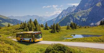
Line 126, Grindelwald – Bussalp (mountain line) /summer
Timetable
You can find the timetable for line 126 in the timetables.
Search for a connection
Directly plan your journey at the start of the offer.
Arrival journey
 to Lochsteinen from Gaggi Säge
Further information
Find more information about the journey here (hiking map, altitude profile and/or a video).

Erklärungstext zu Höhenprofil
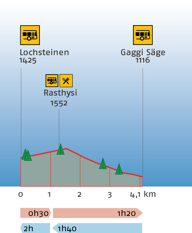
The hike starts at Lochsteinen at 1,425 metres above sea level. The path leads up to Rasthysi (restaurant) at 1,552 metres above sea level. This is the highest point of the hike. There is a refreshment stop here. At this point just over 1 kilometre of the 4.1-kilometre route have been completed. You can expect a walking time of 30 minutes. The route continues downhill to the end of the hike, Gaggi Säge at 1,116 metres above sea level. The entire hike takes about one hour and 20 minutes to complete. The hike can be interrupted en route, as there is a bus stop at the Rasthysi. Hiking into the opposite direction, you should expect a hiking time of one hour and 40 minutes to reach the highest point of the hike, Rasthysi at 1,552 metres above sea level. Plan a total of 2 hours for the entire hike to Lochsteinen at 1,425 metres above sea level.
Plan and organise your journey
Have the entire hike compiled as a PDF or download the GPS file.
Our tip: Open the GPS file conveniently on the go with the hiking planner app from the Bernese hiking trails.
Share the journey with your friends.